Cycling network
Cyclists map with additional information
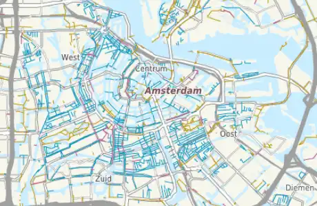
The cycling map provides both a good overview of international, national and regional routes, as well as a detailed overview of the cycling routes structure in cities and towns. All data are from the collections of the OpenStreetMap project and can be arbitrarily combined with the checkboxes in the rigth menu.
Rendered bike path properties
The "bike trails" allow the presentation of the captured cycle network in the map. There is a distinction between driving opportunities on sidewalks, on streets and in bus lanes.The separate roads cycle paths and bicycles paths only can be watched there. For the guys with local knowledge problems with the OSM data can fast be found and changed in Josm by a right mouse click on the map.
Since the data is completely updated weekly, these changes can be found after a few days in our maps.
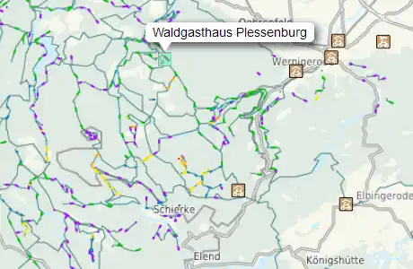
Mountain bike trails with grades
We have selected mountain bike trails with different difficulty grades for the map. For this area in OSM is already some data recorded, but there is also much to grasp. Guys with local knowledge can directly start the Josm editor and beginn to fill in the missing information after a click with the right mouse button.
Change and supplement data

Clicking the right mouse button on the map opens a context menu. From this menu, you can select an editor for OSM, where then the selected map section is opened for editing.
To edit you need a benevolent OSM account, you can create at any time for free.
By using the menu, it is also possible to display an aerial view of the current section.
Remember clippings and share them
You can save map sections with the bookmark function of your browser. Here, the map section and all selected POIs and geometries are stored.
You can also copy and save the current browser line (URL) easily. The link thus produced can be send to someone. After clicking on this Link the map will open then as you have set it with the switchable POIs.


